

Our Services
Thermal Inspections
Performed with:
DJI Matrice M300T RTK and Skydio X10
Detailed Thermal roof inspections using various cutting edge cameras to find water leaks, thermal heat loss, damaged tiles, or overheating AC units.
LiDAR Point Clouds
Performed with:
WingtraOne GEN II and Mavic 3E
Minimize survey time while producing excellent results, we can produce detailed Point Clouds and post-processed datasets using Pix4D, QGIS, FLIR and other software tools. In this example, the tallest tree in a specific sector of mountainside, was detected.
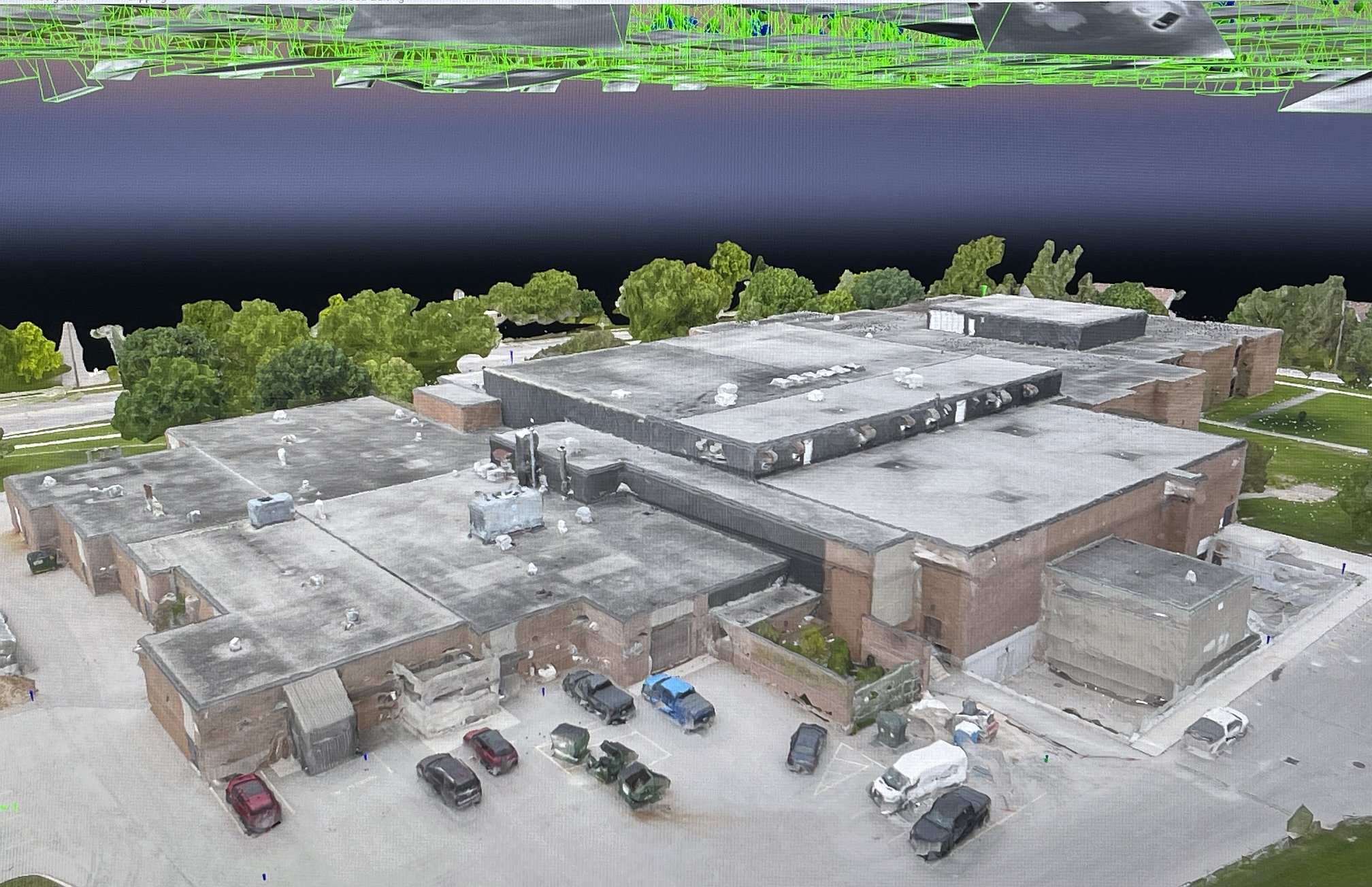
Photogrammetry
Performed with:
DJI Mavic 3 Enterprise
The M3E is a very popular aerial survey drone, shown here performing a 3D RGB Photogrammetry scan of a high school located in London Ontario.
Drone Operations
Skydio X10
w/RTK
We recently had the opportunity to test in a real-time environment, several Industry-leading Enterprise level drones, and the Skydio X10 w/RTK and built-in AI, has been very impressive. With many unique features, the Skydio X10 provided excellent RGB and LiDAR Thermal survey datasets via it’s VT-300 L radiometric camera.
WingtraOne GEN II
w/PPK GNSS
Fast, stable and accurate VTOL LiDAR mapping drone.
It was a pleasure to use the WingtraOne GEN II to map a college campus in London ON Canada. Utilized both RBG and LiDAR, to create detailed 2D Orthomosiacs, and 3D Point Clouds.
DJI Mavic 3T Enterprise and Matrice M300T
Enterprise drones with RTK and Thermal
We have successfully tested both DJI enterprise mapping drones using Thermal and RGB datasets for LiDAR and Photogrammetry surveys, producing excellent results from each drone.
Professional Video
Make it stand out
It all begins with an idea. Maybe you want to launch a business and need website content. Or require a Real-estate or car show photoshoot. Or maybe you need to do property inspection or aggregate volumetric calculation.
Whatever it is, the way you tell your story online can make all the difference, and DroneFlight.ca can help.